
Vietnam Weather by Region: How to Plan the Best North-to-South Trip
- Home
- Destinations
- Việt Nam
- Vietnam Weather by Region: How to Plan the Best North-to-South Trip
Vietnam stretches over 1,600 kilometres from north to south. The weather in Hà Nội has nothing to do with the weather in Hồ Chí Minh City, and neither of them tells you what is happening in Hội An.
Vietnam is too long, too mountainous and too monsoon-affected for one simple best time to visit answer. The best month for Hà Nội is not always the best month for Hội An, and a rainy afternoon in Hồ Chí Minh City is not the same thing as a flood warning in Central Vietnam. If you are planning a full north-to-south adventure, you are crossing several very distinct climate systems in one trip.
Understanding how the regions overlap can be the difference between an easy-going trip and missing out on activities thanks to Vietnam's impressive typhoons.
This guide breaks Vietnam's weather down by the regions you'll likely be visiting, and explains why the country's climate is so varied, which should help you choose the best route and month for the kind of trip you want to take!
The Best Time to Visit Vietnam
Best all-round: March to April — the strongest compromise if you are travelling north and south
Best North Vietnam: March to April, October to November — clearer, cooler, better for walking and city exploring
Best Central Coast: February to August — better for beaches before the late-year rains
Best South Vietnam: December to April — drier and sunnier for Hồ Chí Minh City and the Mekong Delta
Wet-season atmosphere: May to September — dramatic weather and fewer crowds
Highest caution: September to November — Central Vietnam typhoon, heavy rain and flood risk
March and April are the most cited best time recommendation because they offer the lowest number of obvious weather compromises across the whole country. That said, no month is perfect everywhere, and south Vietnam can already be very hot and humid by April. This is a guide to best odds, not guarantees.
Why is Vietnam's weather so complicated?
It is a very long, narrow country
Vietnam stretches more than 1,600 kilometres from north to south. Hà Nội and Hồ Chí Minh City are further apart than London and Marrakech. At any given time, one region can be basking in dry-season sunshine while another is dealing with a typhoon.
The country also has significant mountain ranges, a long coastline exposed to the South China Sea, and elevation differences that cause the shift in the climate to be considerable, even during a short trip. The north has four distinct seasons, including a proper winter. The south runs on a more tropical rhythm of wet and dry. The central coast, caught between the two, operates on its own schedule entirely.
This is by far the best way to travel Vietnam

Two monsoons run the show
Vietnam's weather is governed by two separate monsoon systems, each affecting different parts of the country at different times of year.
The southwest monsoon dominates from roughly May to October. It brings warm, moist air and drives the rainy season across southern Vietnam and many inland areas. This is the wet season most travellers associate with Southeast Asia — reliable afternoon downpours, high humidity, beautiful green landscapes.
The northeast monsoon runs from roughly October to April. It brings cooler, drier air into the north, which is why Hà Nội has a recognisable winter. Along the central coast, however, the northeast monsoon interacts with the sea, the mountains and late-season tropical storms to produce a different and more disruptive kind of wet weather. This is why Hội An and Huế get their worst rain in October and November, long after the south has dried out.
Typhoon vs Monsoon: What's the Difference?
A monsoon is a seasonal wind system. It is a predictable, large-scale shift in wind direction that brings wet or dry conditions for months at a time. It is a season, rather than a storm.
A typhoon is a storm, rather than a season. It is a rotating tropical storm that forms over warm ocean water. It is a singular weather event, and can often be dangerous, but relatively short-lived.
Mountains make rain behave differently
The Trường Sơn mountain range runs along the western edge of central Vietnam, bordering with Laos, and is one of the most important pieces of geography for understanding why the country's weather is so varied.
During the southwest monsoon, moist air moves in from the west and is forced upward by the mountains. It cools, condenses and drops its rain on the western slopes before arriving on the central coast as a drier, warmer wind. This is why the Central Coast region is often sunny and dry in June and July when the rest of the country is wet.
In the cooler months, the process reverses. Easterly winds pick up moisture from the South China Sea, hit the same mountains from the other side, and release it along the central coast. Combined with late-season typhoons, this creates the concentrated, intense rain that can cause serious flooding in coastal cities like Hội An and Huế in October and November.


Vietnam Weather By Region
Far North Mountains: Sapa, Ha Giang, Mu Cang Chai
Best for: Rice terraces, mountain roads, trekking, mist, cooler air and dramatic landscapes.
Best months: March to April and September to November.
Sapa, Ha Giang and Mu Cang Chai sit at elevations where the tropical warmth of the lowlands disappears entirely. This region gets a true winter. In the coldest months of December and January, temperatures in the highlands can drop to near zero, with occasional frost and, in rare years, snow on the highest peaks.
Spring (March to April) brings warming temperatures, clearer skies and the famous flower season around Hà Giang and Sapa. Autumn (September to November) is the other prime travel window, with lower humidity and blue skies.
In the wet season (roughly June to August) it is a bit of a trade-off. Heavy rain makes the rice terraces vivid green, and waterfalls are raging. Though rain can ruin some planned activities, it truly is a beautiful time for exploring. And if you are into photography it can be more interesting than clear-sky conditions.

Hà Nội, Ninh Bình and Hạ Long Bay
Best for: Food, old quarters, temples, limestone landscapes, boat trips and self exploration.
Best months: March to April and October to November.
Hà Nội has Vietnam's most pronounced four-season weather, including a proper winter between December and February, a humid spring that often brings crachin (persistent mist and drizzle), a hot and wet summer, and a lovely autumn that brings the most travellers to the region.
However, even in the golden March-to-April window, Hà Nội is hot. We visited in late March and early April, and even though we've spent the better part of a decade living in the tropical heat of Darwin in Australia, exploring Hà Nội on foot everyday was still a very hot and sweaty experience. The combination of temperature and humidity can become exhausting, even if you are used to it. Pack accordingly, and build in rest time.
Summer (May to September) brings Hà Nội's heaviest rain, particularly July and August. The city handles it really well, with street food stalls still operating despite flooding roads.
Hạ Long Bay's weather generally mirrors Hà Nội's, with the addition of sea mist in cooler months. October to April is the most reliable window for cruises, with lower storm risk. July and August bring the highest temperatures and the possibility of tropical storms that can lead to cruise cancellations. If you are booking a Hạ Long Bay cruise in summer, check cancellation policies.
Ninh Bình is best visited in the same windows as Hà Nội. Spring and autumn are when the limestone karst scenery is clearest and most photogenic.
Keen to Cruise Ha Long Bay/Lan Ha Bay?
We LOVED our Lan Ha Bay cruise with Tulip Cruise. It was very bougie but still beautifully intimate, and was one of the most luxurious experiences we have ever had! We cruised, kayaked, explored Cat Ba Island by bike, swam in the bay, and even went squid fishing!

Book with Klook
Book Halong Bay cruises and Hanoi tours
Find popular experiences across Northern Vietnam:

Halong Bay Ambassador Luxury Cruise Day Tour from Hanoi
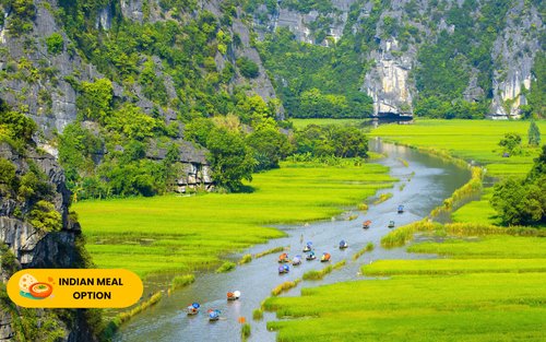
La Casta Premium Cruise Halong Bay 1 Day Tour
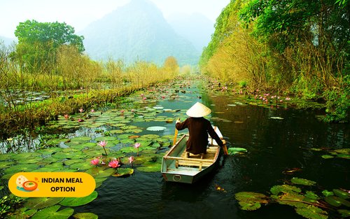
Halong Bay Heritage Cruise Day Tour with Kayaking
Phong Nha and North Central Vietnam
Best for: Caves, jungle, rivers, karst landscapes and adventure tours.
Best months: February to August. September to November requires more caution.
Phong Nha is often grouped with the Central Highlands in travel guides, but it is better understood as inland North Central Vietnam. Its weather follows the central Vietnamese pattern — relatively dry and hot through the middle of the year, with a rainy season that peaks later than the south, roughly September to November.
What is a Karst Landscape?
Karst is terrain formed when limestone rock is slowly dissolved by rainwater over millions of years, creating towers, cliffs and cave systems. Vietnam sits on one of the largest limestone karst zones in Southeast Asia — which is why Hạ Long Bay, Ninh Bình and Phong Nha all share that same dramatic, jagged scenery despite being hundreds of kilometres apart.
The practical consequence of this for travellers is cave access. Some of Phong Nha's water caves and jungle routes are affected by rising river levels during the wet season, and a handful close entirely for periods of the year.
Son Doong, the world's largest natural cave (by volume), has a set access window that currently runs from January to August. If a specific cave tour is an important part of your itinerary, (I recommend this one, it was one of the highlights of our time in Vietnam),build your route around the access calendar and check directly with operators before booking.
The dry season (roughly February to August) is the most straightforward window. Temperatures climb from May onwards — the Lào wind, a hot dry air mass that descends off the Trường Sơn range, can push Phong Nha into the high 30s — but the rivers run clear, the karst is a beautiful, vivid green. This is the time when cave access is at its most reliable.

Central Coast: Huế, Đà Nẵng and Hội An
Best for: Beaches, old towns, food, lanterns, imperial history and coastal road trips.
Best months: February to August, with March to May the easiest balance.
This is the region that most consistently surprises travellers, and understanding its weather pattern is arguably the most important piece of planning for a north-to-south Vietnam trip.
The Central Coast is dry and warm when most of the country is wet. From roughly February to August, Hội An and Đà Nẵng enjoy long stretches of sunshine while both Hà Nội and Hồ Chí Minh City are either in monsoon or building toward it. July and August are peak beach season on the central coast.
Hội An's 2025 Floods
The most recent flood in Hội An occurred only months before we arrived. It was incredible that during our time exploring Old Town we couldn't see these impacts at all. The town bounces back incredibly fast from these devastating flood episodes!
From roughly September to November the Central Coast faces its most challenging weather. Typhoons track across the South China Sea and make landfall along this stretch of coast. Multi-day rain, strong winds and flooding are common. Hội An, built on the banks of the Thu Bồn River in a low-lying floodplain, is particularly vulnerable. The Old Town floods most years in October and November. Some years it floods severely.
For the clearest Central Coast conditions, aim for March to May. By this point in the year the rains from the previous season have eased, temperatures are warm rather than blindingly hot, and the beaches and old town are at their most accessible.

Book with Klook
Book Hoi An lantern and Da Nang tours
Explore the best of Central Vietnam:

Coconut Forest with Dinner & Hoi An Memories Show Ticket

Coconut Forest Basket Boat Ride, Crab Fishing with Lunch or Dinner

Boat Ride Ticket and Release Lantern at Hoai river in Hoi An
Central Highlands: Đà Lạt and Coffee Country
Best for: Coffee plantations, waterfalls, cooler air, pine forests, and highland roads.
Best months: November to April for drier, clearer conditions.
Đà Lạt is a bit of an outlier in most people's Vietnamese itineraries. It is a hill station at around 1,500 metres elevation that the French built as a cool-weather retreat. And today it still functions as exactly that!
While the rest of the country swelters, Đà Lạt averages around 18 to 22°C year-round. It has earned the nickname "City of Eternal Spring," which is great marketing really!
The dry season (roughly November to April) is the easiest time to visit. You'll have clear skies, cool mornings, low humidity and good conditions for exploring the surrounding coffee and tea plantations. The rainy season (April to October) brings heavier rainfall. Waterfalls run at full strength, the landscape is lush, and roads can be muddy. Any outdoor plans you've made will need to be flexible, but the trade-off is greener, more dramatic scenery.
Hồ Chí Minh City and the Mekong Delta
Best for: Street food, markets, river life, cafés, urban energy and, if you choose it, tropical rain.
Best months: December to April for dry-season simplicity.
Southern Vietnam felt a little bit like home for us, but with the opposite seasons throughout the year. From December to April the region is in its dry season, and from May to November it is the wet season. Temperatures stay warm year-round, rarely dropping below 25°C and regularly pushing into the low 30s.
The dry season is undeniably easier for travelling, which is certainly why it attracts the larger crowds. You'll have lower humidity and lovely sunshine. If you are visiting for the first time and want uncomplicated weather, December to March is the sweet spot.
But as a girl who fell in love with the tropics after living in Northern Australia for so long, I would like to make a case for wet-season travel.
Generally, in the tropics, the wet season doesn't mean it is raining constantly, all-day-everyday. Yes, it is hot and humid, and the air feels like a wet blanket that has been in the drier for about 5 minutes, but often in the morning you get a sweet-spot where it is a little cooler, not raining, and the wet, lush environment is just so pretty. Then, usually in the mid to late afternoon, a thunderstorm will move through with massive bangs and big lightening strikes, and heavy rain, and if you are tucked away in a cosy cafe or a lovely room with a view, you can have some of the most memorable views of your whole trip!
Want to get to know Ho Chi Minh City in the best way possible?

The caveat, as always, is the difference between atmospheric rain and genuine disruption. The Mekong Delta is low-lying, and heavy wet seasons can cause significant flooding in some areas. It is worth checking local conditions if you are planning to travel by boat into more remote parts of the delta between August and October.

Book with Klook
Book Mekong Delta and Cu Chi Tunnels tours
Discover Ho Chi Minh City and the southern delta:

Mekong Delta Day Tour from Ho Chi Minh with Luxury Limousine Options
Cu Chi Tunnels & Mekong Delta Tour with Luxury Limousine Options

Cu Chi Tunnels Half Day Tour
The Best Vietnam Route for Good Weather
Month-by-Month Quick Reference
Far North: ✦ Best Mar-Apr & Sep-Nov | Wet Jun-Aug | Cold Dec-Feb
Hà Nội / Hạ Long: ✦ Best Mar-Apr & Oct-Nov | Hot/wet May-Sep | Cool Dec-Feb
Phong Nha: ✦ Best Feb-Apr | Hot May-Aug | ⚠ Caution Sep-Nov
Central Coast: ✦ Best Feb-May | Beach Jul-Aug | ⚠ Typhoon risk Sep-Nov
Central Highlands: Dry Nov-Apr | Wet May-Oct
South Vietnam: ✦ Dry Dec-Apr | Wet May-Nov
March to April: The Golden Window
This is the most reliable national compromise, and for most travellers planning a first north-to-south trip, it is the best starting point.
We did this exact route (by accident, because we didn't know we were coming to Vietnam until 3 days before). We started in Hồ Chí Minh City and headed north to Hà Nội over three and a half weeks in late March and early April, and the weather was very stable throughout. The south was warm and dry, the Central Coast was clear and beach-ready, Phong Nha was dry with full cave access, and Hà Nội, while hot and humid even by tropical standards, was simple and straightforward.
Suggested direction: South to north. Starting in Hồ Chí Minh City and finishing in Hà Nội or heading further north into Sapa or Ha Giang means you are moving through each region at its most favourable point in the season.
Suggested route: Hồ Chí Minh City and the Mekong Delta → Hội An and the Central Coast → Huế → Phong Nha → Hà Nội → Ninh Bình → Hạ Long Bay → Far North if time allows.
October to November: Best for the North
If the far north is your priority, September to November is worth planning around. October in particular is frequently cited as the best month in northern Vietnam with cool air, clear skies, and the paddies at their most photogenic.
Suggested direction: Go north to south. You will move through the central coast early and get south before the most intense of the storm season peaks.
May to September: For Travellers Who Love the Rain
Southern Vietnam in wet season is warm, very atmospheric and often more interesting than the dry-season version. The northern mountains are lush, and if rice terraces in vivid green sound more appealing than golden harvest terraces, June to August is actually the right time for the far north.
The important distinction is Central Vietnam. From roughly September onwards, the weather on the central coast shifts from ordinary wet season into something a little bit more serious at times. Typhoons are common in Huế, Đà Nẵng, Hội An and sometimes Phong Nha. Late September to November on the central coast requires a little bit of extra planning (but by no means is it a reason not to go!)
What to Pack for Vietnam's Weather
Golden season (March to April): Light, breathable clothing for most of the route. A light rain jacket is worth carrying — not for sustained rain, but for the occasional afternoon shower that can appear even in the dry season. Pack a warm layer for mountain areas and northern evenings in March.
North Vietnam in winter (December to February): A proper fleece or light down jacket for Hà Nội, and heavier layers if heading to Sapa, Ha Giang or other highland areas. Cold and damp is more unpleasant than cold and dry.
Hot season on the central coast (May to August): Sun protection is non-negotiable. A high-SPF sunscreen, UV-protective layers for beach days, and electrolytes for the heat. The central coast in July is very hot.
Rainy season anywhere: A small compact umbrella or packable rain jacket, a dry bag or waterproof pack cover, quick-dry clothing, and waterproof footwear or sandals that can handle wet streets. A flexible attitude toward timing is more useful than any piece of gear.
Caves and mountains (Phong Nha, far north): Grip shoes or trail runners, layers for cave interiors which are cooler than outside, insect repellent, and spare socks. Always check tour cancellation policies before booking non-refundable adventure activities.
So, When Should You Go?
If you want the safest all-round window for a full north-to-south route, plan for March or April.
If the far north is your priority — golden rice terraces, mountain roads, cooler trekking — look at September to November, and move through the central coast before October deepens.
If you want the Central Coast at its best — beaches, long sunny days, Hội An at full brightness — aim for February to August, with March to May the easiest balance.
If you love wet-season travel, do not automatically avoid May to September, especially in the south and northern mountains. The rain has its own rewards.
And wherever you go: treat Central Vietnam's late-year storm and flood season as its own category of planning. It is not just ordinary wet-season travel. Know the difference, plan accordingly, and you will be fine.
Temperatures and seasonal dates are general guides based on historical climate patterns. Vietnam's weather varies year to year. Always check current forecasts before and during travel, particularly for the Central Coast during typhoon season.