
Lerderderg Gorge Circuit
Stunning, and surprisingly tough!
- Home
- Destinations
- Australia
- Victoria
- Lerderderg Gorge Circuit
Lerderderg Gorge Circuit
A steep, rocky and river-crossing-filled circuit through Lerderderg Gorge that is far more demanding than its 8km distance suggests.
At a Glance

Allow 3 to 5 hours for the full circuit. The distance is only 8km, but the terrain is challenging for less experienced walkers, so factor in plenty of rest stops on the climb and descent.
This is a Grade 4 hike and it will test your legs regardless of your fitness level. The steep ascent, rocky descent and river crossings make it much more demanding than the distance suggests.
Probably not, unless you are particularly fit or happy to take it very slow. If you have mobility issues or bad knees, this is one I would probably give a miss.
Yes. Expect around four river crossings on the full circuit. In dry months they are usually manageable, but in winter and spring water levels can rise considerably and crossings may become difficult or impassable.
Most guides recommend anti-clockwise, but we walked clockwise and preferred it. Clockwise means ascending the steep but more straightforward dirt track first, then descending the rockier section.
Late summer through autumn is ideal. River levels are usually lower, crossings are more manageable, and clear autumn light in the gorge can be beautiful. In wetter seasons, check river conditions before setting out.
What to Expect on the Lerderderg Gorge Circuit
This walk is ideal if you:
I attempted it, and succeeded, but only after lots of complaining, on a rare Friday afternoon with Chris and my beautiful sister-in-law, for whom this was only her second hike ever.We were expecting a cruisy afternoon walk in the sunshine, not the Grade 4 hike that took us straight up a hill and then straight back down again.
On paper, 8km sounds like a casual half-day out, which is why we picked this one.In reality though, the fairly relentless gradient meant that this hike demanded more from our legs and our lungs than the distance implied.
It was a great challenge though, and a truly beautiful landscape.The Lerderderg River was clear as glass on the stunning mid-May day we were there, and lined with ancient river gums, cutting through a gorge that took millions of years to form. The views from the climb stretch all the way to Melbourne's CBD. On a clear day you can see the skyscrapers of the city nestled together like a little pimple on the horizon.
Expect:
Flat, beautiful riverside walking to start
Around four river crossings, rock-hoppable in dry conditions
A long, steep ascent with expanding views back towards Melbourne the whole way up
A short stretch of flat vehicle track at the top before the descent begins
A steep, rocky descent that is tough on the knees and requires your full attention
A peaceful return along the river to finish

Best Time to Visit
Late summer through autumn is ideal for the Lerderderg Gorge Circuit.River levels are usually at their lowest, crossings are more manageable, and if you're lucky enough to get a clear autumn day, the light through the gorge is just beautiful.
If walking in the wetter seasons, check ahead to make sure the water crossings are passable.This is not the track to wander into after heavy rain and simply hope for the best.
Getting There
Lerderderg State Park sits in the Macedon Ranges, northwest of Melbourne near Bacchus Marsh.It is about an hour from the Melbourne CBD via the Western Freeway.
On weekends and sunny days this walk becomes incredibly popular.On particularly beautiful days, arrive early to get a park and have the track mostly to yourself.
There are two drop toilets at the trailhead.They are fine, functional and generally quite clean.
Dogs are not permitted on the circuit walk or on the track to Grahams Dam, so your pooches are going to have to sit this one out.
This walk is not ideal if you:
A Little History
This gorge has been forming for roughly a million years.Look closely as you are walking to spot the intricate layers of Ordovician sandstone, slate and siltstone that form the gorge walls.
Movement along the Rowsley Fault, located on the western edge of Port Phillip Bay near Geelong, caused the land to uplift, steepening the gradient of the Lerderderg River.The result is a gorge that is up to 300 metres deep in places, with vertical cliff faces and boulder-strewn river channels.
The Rowsley Fault
The uplift caused by the Rowsley Fault is responsible for the formation of the Brisbane Ranges and the Lerderderg Gorge.
This is the traditional Country of the Wadawurrung people, specifically the Marpeang balug clan, whose connection to this land predates European arrival by many thousands of years.The Wurundjeri Woi Wurrung people also hold connections to this Country.
The name Lerderderg is thought to derive from the Wurundjeri word Larderdark, meaning stone house and peppermint gum.
European settlers arrived in the early 1830s, and gold was discovered nearby in 1851.The mining that followed left its mark on the landscape in ways still visible today, from water races carved into the hillsides to old mine shafts scattered through the surrounding bush.

Mackenzies Flat to Grahams Dam
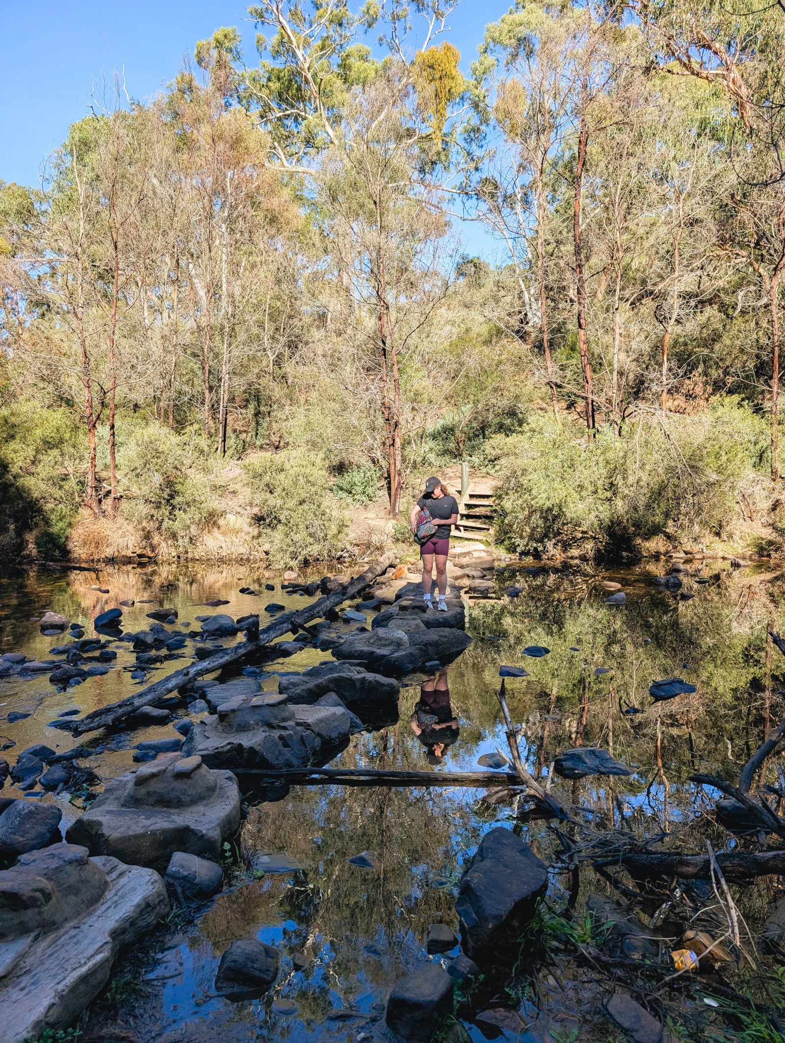
From the picnic area, the track follows the Lerderderg River north through open eucalypt forest.The gradient is pleasant and includes two small and fun river crossings. The path is wide and well-worn, and the river remains right beside you for this first stretch.
In dry autumn conditions, the river here is such a highlight.On our visit in mid-May, the water was absolutely still and completely clear. It was possible to see every rock on the riverbed. This area truly felt like a world away from Melbourne, despite being less than an hour’s drive.
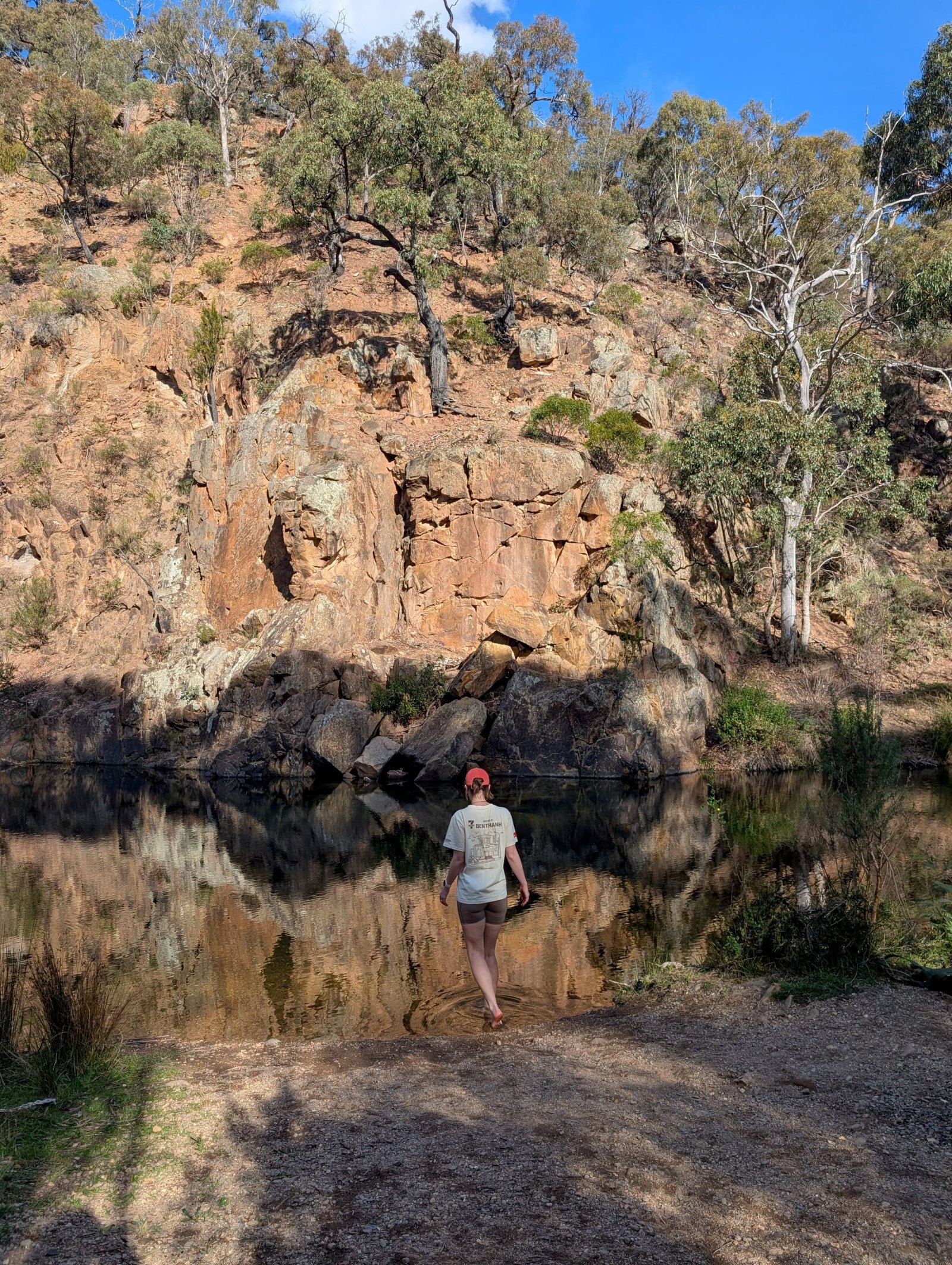
You’ll first reach Grahams Dam, which is a great little walk, and a swim if you are brave, in itself, without needing to tackle any steep sections.In the summertime this glorious waterhole becomes extremely popular with day-trippers from Melbourne and Geelong descending on the landscape to cool off.
This section of track, from Mackenzies Flat to Grahams Dam, is accessible to most people, including those not doing the full circuit.
The Climb
At Grahams Dam, the circuit begins.If you're walking clockwise, which we recommend, you'll turn left and begin climbing a steep but less rocky section of track that seems to go on forever.
The climb is longer and steeper than it looks on any map.It starts firmly and doesn't really let up much at all. Take plenty of breaks, because along this section, chances are, the best views back across the city are right behind you.
The top of the climb is honestly a little anticlimactic by comparison.Tall gum trees pretty much block out any views you might have from the summit.


The Blackwood Ranges Track
At the top of the ascent, the track joins the Blackwood Ranges Track, which is a wide, flat vehicle access trail.After the climb, this little stretch is a relief for the legs, but sadly only runs for about 600 metres before you reach the turnoff for Link Track 1.
The Descent
Link Track 1 drops steeply back into the gorge.It is rocky, quite loose underfoot in places, and very unforgiving on the knees.
There were two or three moments along this section where the step down was steep enough that I sat down and shuffled on my bum a little, rather than risk a steep faceplant.Walking poles would be helpful here, if you have them and like using them.
The views on this descent are also very beautiful, but in a different way.You're looking straight down the valley and back up the river, which offers a completely different perspective from the climb up.


The Return Along the River
The walk back to Grahams Dam was longer than I was expecting, but it is flat, and follows the river the whole way, offering glimpses of the towering gorge walls and stretches of crystal clear river that looked spectacular in the golden May sunshine.
On our return, my sister-in-law Megan and I braved the cold, and soaked our jelly-legs in the icy cold water at Grahams Dam.I lasted a few minutes before the cold water made my ankle ache. A braver person would take the full body cold plunge, but I am not that person.
You’ll arrive back at Mackenzies Flat, where if you want to make a full day out of it, you should bring a picnic for afternoon tea.There is plenty of grass to laze around on, and BBQs for a cheeky snag or a burger.
In lieu of that, we drove into Bacchus Marsh for a beer, and chips and gravy at the pub, which we had been dreaming about since we started the walk.


Track Notes and Things to Be Aware Of
Navigation is important.The trail is mostly signposted, but we did make a few wrong turns. Thankfully, we had downloaded the AllTrails map, which was extremely helpful to check our route.
There is no water available once you leave the river.Carry at least two litres per person. The ridgeline section is fully exposed and gets hot quickly, especially in summer.
Good shoes are a must.The track involves loose rock and steep steps, and if you have knee issues, the descent in particular will be hard. Walking poles will make a difference.
The surrounding park is riddled with old gold mining infrastructure, including unstable shafts.Stick to the marked track.
This walk is popular, particularly on weekends and warm days.The river section and Grahams Dam fill up quickly. The circuit itself thins out after Grahams Dam, but can still get very busy on good days.
What to bring


Lerderderg State Park sits on the traditional Country of the Wadawurrung and Wurundjeri Woi Wurrung peoples, who have cared for this land for thousands of years.We acknowledge their deep and ongoing connection to Country and pay our respects to Elders past and present.
Explore Some More

Bivouac Bay
I love a walk with plenty of variety, and this one made the kilometres feel like mere metres!

Duckhole Lake
An accessible adventure into Tasmania’s wild south, and a perfect introduction to its karst landscapes.

Lake Esperance
A walk through waratahs and a lush Tasmanian alpine landscape

South Cape Bay
A beautifully varied walk to the very end of the road, and the edge of the continent.

Hartz Peak
A short but impactful hike to the summit of Hartz Peak, showcasing a dazzling array of plant diversity!

Tahune Airwalk
A spectacular elevated walkway through the forest canopy, high above the rivers of Tasmania's wild southwest.

Fluted Cape
If you only have time for one short walk on Bruny Island, make it this one.

Labillardiere Peninsula
Pack plenty of snacks and your swimmers, and turn this hike into a full-day adventure

Waterfall Bay
Spectacular coastal views, dramatic rock formations, and some of the best wildlife spotting on the Tasman Peninsula, all within a casual clifftop stroll.

Cape Raoul
A challenging and exhilarating walk to one of Tasmania's most dramatic coastlines, and some of the best dolerite column formations on the planet.

Coal Mines Historic Site
Crumbling convict-era ruins, underground cells, and sweeping views of Norfolk Bay, all within a short and easy walk.

Cape Hauy
A stunning loop walk along one of Tasmania's most dramatic coastlines, with towering dolerite cliffs, endless ocean views, and some of the best whale spotting on the peninsula.